
Corsica updates the map of demarcated areas for Xylella fastidiosa
The Regional Directorate of Food, Agriculture and Forestry of Corsica has made available on May 23, 2016 the new map of demarcated areas for Xylella fastidiosa in the island.
The extension of the buffer zone (beyond the infected zones) is now covering 3,917 km².
So far 249 outbreaks of Xylella fastidiosa have been identified in Corsica, 237 of which are located in Corse-du-Sud and 12 in Haute-Corse.
The complete list of the 176 municipalities now included in the demarcated areas is available at this link.
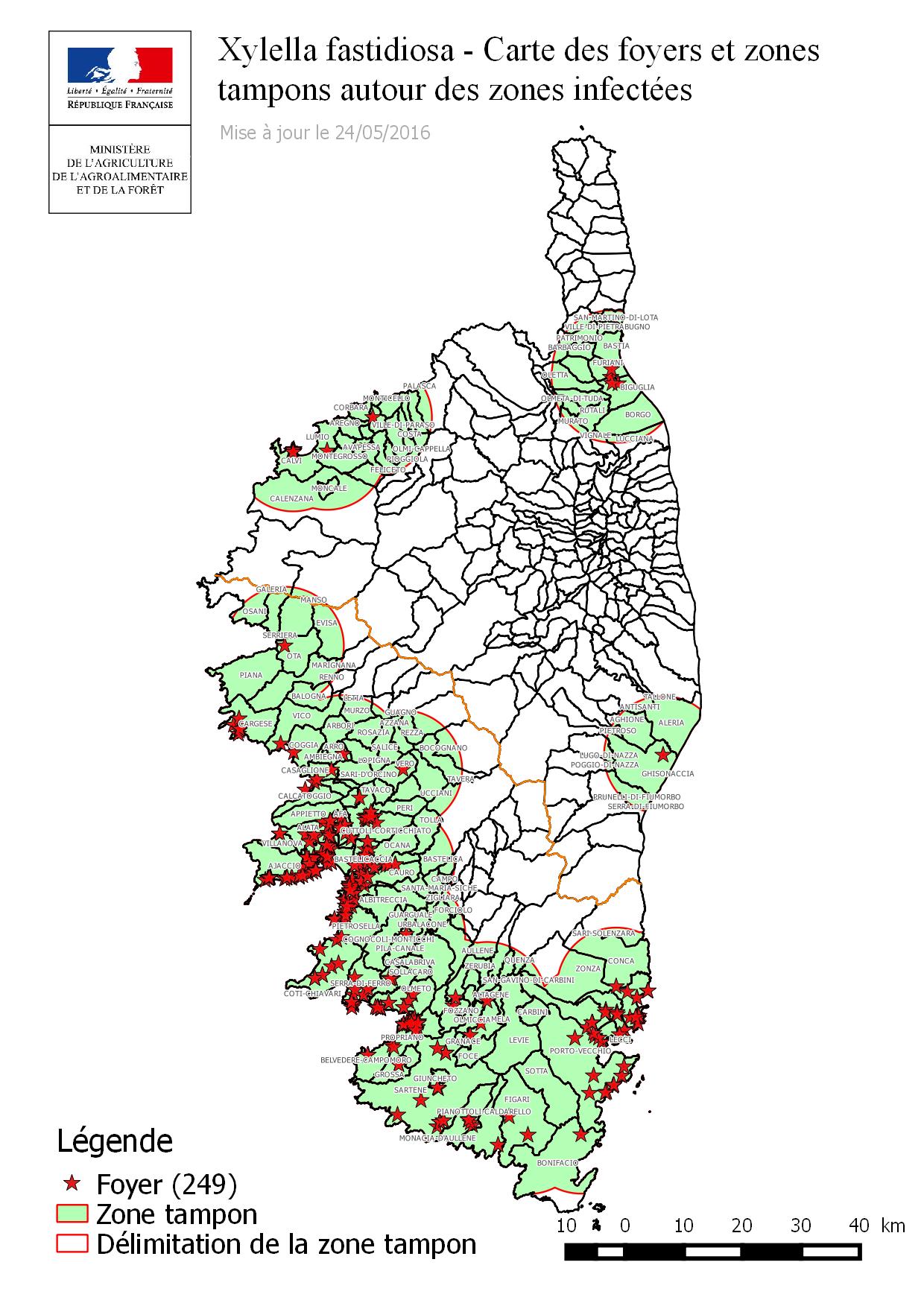
Map of Xf outbreaks and demarcated areas in Corsica on May 24, 2016


